 |
|
|
| Author |
Message |
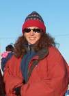
Misty_Nikula-Ohlsen
Joined: 23 Mar 2004
Posts: 74
Location: Barrow, AK

|
 Posted:
Thu Jul 01, 2004 6:23 am Posted:
Thu Jul 01, 2004 6:23 am |
  |
What a BUSY two days!
We started out yesterday morning with a full plate of tasks. First we went to BEO to get the data and run the generator like we do every day but we also did the first part of our weekly field measurements and instrument calibrations. At each tower site, we take two field measurements thaw depth and soil moisture. To get the measurements, we walk along one of several preset paths that radiate out from the tower along a compass heading. These are called transect lines. Along the transect line there are small wooden dowel stakes that mark the locations to take measurements. At the BEO tower there are 3 transects, one heading directly north, one 60 degrees east of north and one 60 degrees west of north. Each transect at BEO has 20 stakes spaced 10 meters apart. We take 3 thaw depth and 3 soil moisture readings at each marker.
I was in charge of the thaw depth measurements this time. Thaw depth or active layer is the part of the ground that has melted since winter. Beneath the active layer is the permafrost, the part of the ground that never thaws. Measuring the thaw depth in the tundra over the course of the summer can help scientists understand how quickly the temperature and weather here are affecting the part of the ground that is usable by plants and insects.

Walking a transect and taking measurements (Photo by Kim Davis)
To measure thaw depth, you take a steel rod that has a scale marked on it in centimeters. The rod has a T handle on the other end. You take the rod and shove it down into the muddy, melted layer of the ground. Since there are so few rocks in the dirt here and nowhere for water to run off or soak up (the ground is frozen about 10-40 cm below the surface where the permafrost starts), it is pretty easy to shove the rod in.

Pushing the rod into the ground (Photo by Kim Davis)
When the rod hits the frozen solid permafrost, it stops.

The thaw depth rod in the ground
Then you reach down with your hand and by pushing down the spongy moss or grasses, you put your thumb on the rod at the ground surface.

Marking the level with my thumb
Then you keep your thumb on the spot on the rod, pull out the rod and read the depth of the thawed ground.

Reading the measurement (Photo by Kim Davis)
To make recording the measurements easier, we just read the measurements in to a small hand-held tape recorder. Then we dont have to carry paper and pen and try to keep things dry, etc. Later on, the data is transcribed into the computer.

Thaw depth measurement tools
While I measured thaw depth, Kim did the soil moisture. Next time we will switch, so I will tell you about that instrument next time, when I learn about it myself. After we took field measurements and fought the mosquitoes that had come out while it was sunny and not very windy, Kirstin and Kim removed the Infrared Gas Analyzer (IRGA) that needed to be calibrated at the lab. The IRGA measures carbon dioxide and water vapor in the air.

Removing the IRGA
Calibration of instruments is important so that their readings are accurate and comparable to one another. Its like synchronizing watches so that everyone meets at the same time later on. Using an an uncalibrated instrument would be like using a ruler that had differently sized inches or were made from rubber bands so the marks could stretch further apart.
The rest of the Tuesday was spent running (well, driving) back and forth to and from towers. First, the recalibrated IRGA needed to be reinstalled at BEO including another 1 km hike in and 1 km hike out. Another IRGA at the CMDL tower needed to also be removed, calibrated, and reinstalled. All in all, even with a 10:30 start, after Kirstin had gotten back on the plane from Atqasuk, and only a brief stop for lunch, we didnt get done until about 5:30 pm. It had been our busiest day . . . so far.
After dinner, we took a well-deserved recreational break and went four-wheeling. Alice Brower, one of the Inupiaq mechanics who words for BASC, had graciously offered to let us use several of her familys four-wheelers (which are a very common and handy form of transportation, here) and one of the other researchers had another. So we had 5 machines and 9 people.

Our four-wheeler group by some grounded ice bergs (Photo by anonymous nice person passing by on beach tour)
We buddied up and rode all the way up to Point Barrow the northernmost point in the United States. From there a long sandy spit runs east and we went all the way down to the end. We had brought some hot chocolate to have warm drinks before we came back in. We saw huge whale bone piles that had been brought out there to keep the polar bears away from town as much as possible.

Whale bone piles on the beach at Point Barrow (Photo by Kim Davis)
The sea ice is close to land there, so we kept an eye out, but didnt see any. It was very generous of Alice to let us use the four-wheelers and a hard-earned respite from work.
Wednesday we got busy on field measurements at CMDL. At CMDL, in addition to thaw depth and soil moisture, but we also do reflectivity measurements. A fiber optic probe measures how much of the suns energy is being absorbed and how much is being reflected by the tundra surface. All of these measurements are taken on transects the same as at BEO three measurements at each marker. However, at CMDL there are more markers and more transect lines. There are seven transects radiating out from the tower starting with north and going every 45 degrees around the compass to due west. An eighth transect at northwest is not done, because the CMDL building is there.
The transect lines at CMDL are much longer, also. There are 20 markers at 10 m, then 5 more markers spaced at 20 m and finally 2 more markers at 50 m. All told the measurements took from 10 am to 4:30 pm. And to top it all off, today was a cold, windy day. It was about 40 F, 15-20 mph winds from the east and blowing fog. Our toes and noses and fingers were very cold! |
Last edited by Misty_Nikula-Ohlsen on Thu Jul 08, 2004 6:09 am; edited 1 time in total |
|
     |
|
Misty_Nikula-Ohlsen
Joined: 23 Mar 2004
Posts: 74
Location: Barrow, AK
|
| Posted:
Thu Jul 01, 2004 6:26 am |
|
So here are two questions for all you math wizards out there:
1. In the last two days, I have done a lot of walking. I walked to and from the BEO tower twice, walked three transects there and walked the 7 transects at the CMDL tower. The information about the transect lines is in the journal entry and the question is how many miles did I walk in the past two days? Then, given the time period that I listed for CMDL and taking out one hour for lunch, what was my average walking speed?
2. In the last two days, I have also taken a lot of thaw depth measurements. Again, the pertinent information is in the journal entry. The question is how many measurements did I take total in the past two days?
The first student who sends in a correct and well documented (work and reasoning shown or described) answer for BOTH questions to my email misty_trec@arcus.org will get a cool prize from Barrow, AK. |
|
|
|
|
|
|
|
View next topic
View previous topic
You cannot post new topics in this forum
You cannot reply to topics in this forum
You cannot edit your posts in this forum
You cannot delete your posts in this forum
You cannot vote in polls in this forum
You cannot attach files in this forum
You can download files in this forum
|
Powered by phpBB 2.0.11
© 2001, 2002 phpBB Group :: FI Theme ::
All times are GMT
| |