

Students in Arctic Research (STAR) | Preparing for Alaska
Field Research in the U.S. Arctic
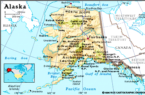
Preparing for Alaska
Many U.S. researchers work in parts of the Arctic outside Alaska, but during TEA 1998, students and teachers worked with researchers in the U.S. Arctic - Alaska. Students and teachers coming to Alaska for field research had a lot to think about and prepare for. During the summer, researchers encounter periods of inclement weather, including snow, rain, and strong winds. The long summer days provide ample time for field work, but intense sunlight and annoying insects can take their toll. Each student and teacher were provided with maps of their future research sites, information about the research projects, a list of items to pack, a list of related Web sites to investigate, information about the Alaskan cities and villages they would visit, and a selection of books.
 Map by
the National Geographic Society, Cartographic
Division
Map by
the National Geographic Society, Cartographic
Division
- Blue line=Cruise to the Northern Ice Pack-a representation of the Polar Sea's voyage from Nome north to Barrow
- Purple Dots=Deering Archeological Excavation-flights from Fairbanks to Barrow, then village hopping to Kotzebue and Deering
- Green Line and Dot=Oil Spill Effects on River Otters in Prince William Sound-flight from Anchorage to Valdez, ferry across Prince William Sound, train ride from Whittier to Portage and drive to Seward
- Lavender line=Tundra Active Layer/Landscape Interactions-travel from Fairbanks to Prudhoe Bay and Barrow via the Dalton Highway, helicopters and small airplanes
- Red Dots=Locations that participants from more than one project visited