( Log In ) Log In is for TREC Teachers & Researchers only
  |
| Janet_Warburton |
 Aug 15 2006, 08:49 PM Aug 15 2006, 08:49 PM
Post
#1
|
 Project Manager Group: ARCUS Posts: 146 Joined: 29-April 05 From: Fairbanks, Alaska Member No.: 13 |
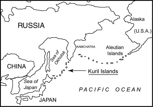
Here are two maps to help follow the project and track Misty's journal entries. The first map is a location map of the Kuril Islands in relation to Russia, Japan, China, and Alaska.
 The second map is a closer view of the Kuril Islands. The red stars indicate approximate locations of the Gipanis and correspond to Misty's journal entries. With each new journal entry, the map will be updated.  |
  |
2 User(s) are reading this topic (2 Guests and 0 Anonymous Users)
0 Members:

|
NSF Acknowledgment & Disclaimer | Time is now: 15th November 2024 - 09:09 AM |
Invision Power Board
v2.1.7 © 2024 IPS, Inc.


