( Log In ) Log In is for TREC Teachers & Researchers only
  |
| Tracy_Alley |
 Jun 15 2006, 10:57 PM Jun 15 2006, 10:57 PM
Post
#1
|
 Advanced Member    Group: TREC Team Posts: 43 Joined: 12-April 06 Member No.: 26 |
On Wednesday, June 14th, I met Michelle Mack and her research crew at 10:00 am to begin the long journey to Toolik Lake Research Station on the famous Dalton Highway. The road to Toolik Lake is not paved. It is about a twelve hour journey on a gravel road traveling at speeds no higher than 50 mph (the speed limit). We averaged speeds around 30 mph. The road is narrow in places and dangerous due to huge delivery trucks traveling to and from Prudhoe Bay. It is a very rough, dusty, and slippery road as well.
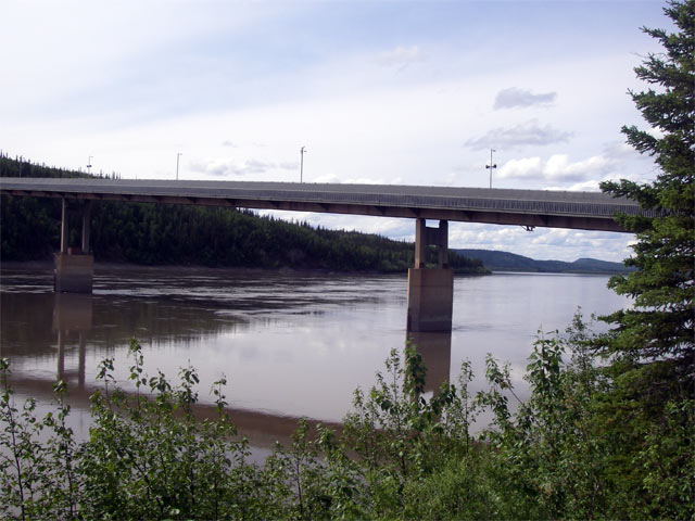
We stopped at places such as the site where you enter the Arctic Circle.  Michelle Mack and Tracy Alley We observed some of the most beautiful scenery I have ever seen in my life. We spotted a moose with her calf walking across a stream. Gigantic mountains covered in snow, beautiful lakes, and untouched land that stretches for hundreds of miles. Two-thirds of Alaskan land is owned by the government.  The Dalton Highway (also known as the Haul Road) was built so crews could construct and repair the Trans-Alaskan Pipeline. We rarely lost site of the pipeline on our journey. It was fascinating to see the pipes carrying oil from our nation’s largest oil field, Prudhoe Bay. We crossed the Yukon River which was very thrilling. I have always wanted to see the Yukon River since I was a child when we learned about the 1898 Gold Rush in history class. The Yukon River is the largest river in Alaska. The source of the Yukon River is the Llewellyn Glacier as determined by hydrologist, Rick Janowitz.  When you travel the Dalton Highway, you need to be prepared for anything such as inclement weather, avalanches, large animals, etc. On the Dalton Highway, you must have a working CB. It is the law of the road in order for people to communicate with you. We communicated with several people along the way. There is one town on the 12-hour drive appropriately named Coldfoot, Alaska. It is located in the foothills of the breathtaking Brooks Mountain Range. The village of Coldfoot was established in the early 1900’s as a gold mining center. There are remnants of buildings left from the gold mining era. It reminded me of a small section of town you would see in an old western movie. There is a post office, gas station, restaurant, and a small inn. There is a National Park Service museum called “Arctic Interagency Visitor Center” located across the highway from Coldfoot. It was a very impressive museum with lots of useful information about the Arctic Circle. We finally arrived at Toolik Lake Research Station around 10:00 pm! I am so glad to be here after a very tiresome journey. Quick Facts about Alaska: Gold is the official state mineral. One third of Alaska lies within the Arctic Circle. Alaska has the lowest population density in the nation. The population was 626, 932 in the year 2000. Alaska has 626, 932 square miles! Half of the population of the state lives in Anchorage. Alaska's name is based on the Eskimo word, Alakshak, meaning great land. |
  |
1 User(s) are reading this topic (1 Guests and 0 Anonymous Users)
0 Members:

|
NSF Acknowledgment & Disclaimer | Time is now: 30th October 2024 - 11:23 AM |
Invision Power Board
v2.1.7 © 2024 IPS, Inc.


