( Log In ) Log In is for TREC Teachers & Researchers only
  |
| Maggie_Kane |
 Jul 21 2006, 07:26 PM Jul 21 2006, 07:26 PM
Post
#1
|
 Advanced Member    Group: TREC Team Posts: 51 Joined: 12-April 06 Member No.: 27 |
July 20, 2006
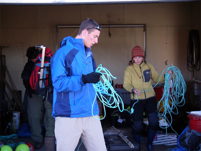
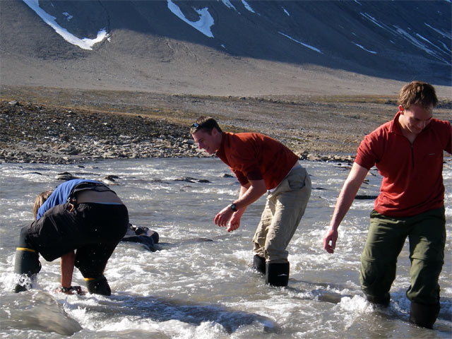
Today started in the garage sorting out what we should bring with us to accomplish our goals. We wanted to get the boats in the water (no small task) and set up some new sediment traps anchored to the lake bottom, so we measured out some rope to the depth of the lake in the location we wanted. How did we know the depth of the lake? Well, Al and Mike have been studying the lake for years, and have lots of really amazing data on it, so we can locate any spot on the lake with a positioning device like a GPS and know how deep the lake is there. Preparing mooring lines  The boat was still docked at Russiakeila and we had to hike to it and push it up and over a ridge and several kilometers along the hilly road to the lake. This was very hard, as we had 2 small wheels on the back of the boat, and we had to lift the front end up and pull or push it. We kept our spirits up and stopped often to tell jokes. That is one of the many wonderful things about this group – they are very funny and love what they are doing, so it is always fun to be working them! Hauling the Zodiac  We had stronger winds today and a lot of fog rolling in from the ocean. This moist air was quite cold, and today felt very different from the warm “beach” days we have been enjoying. As the fog moved inland and encountered the tall mountains between the coast and our valley, it rose up and the spilled over the top and flowed down slope in the most mysterious way. Both boats are Ready  We were able to get both our boats running and put on life vests and traveled down the length of the lake to the south end. It is cold and wet in the boat so we all wear full rain gear. There is an adorable old hut at the south end of the lake that we can store some gear in. We hiked up to the weather station located nearby. It has been recording all sorts of data since Dr. Retelle left last August, and we hoped it would still be standing and recording data. The Weather Station  Then we plugged the computer into the “brain” of the station, and hoped for the best! Plugging in the Computer  We were in luck! Wow! Out streamed tons of data! We didn’t waste our field day looking at it in the field, but were excited to see it after dinner. Then we wanted to find more things that were left over the winter, so we hiked farther upstream to where some temperature loggers were left in the river. These cigar sized objects record temperature into a tiny brain as often as you program them to. Every good scientist keeps good field notes, and we knew that one of the loggers was tied to a rock at the bottom 10 meters from a post set in the ground. Notes  The search began to find it in the very cold melt water stream… Searching…  Leif finds the rock that anchors the logger!  We also wanted to set up some level loggers. These are another tube shaped instrument that has a little “eyeball” that looks up through the water to see how much is over it. That is recorded every few minutes as well, and we hope to be able to see when during the day and year the water level rises. What would make the water level rise over the coarse of a day do you think? Setting up level logger  One last thing (few, it’s been a long day) before we hike home… we wanted to set the sediment traps onto the rope we measured this morning, so we set those up and gently dropped them into the lake in the exact spot we wanted. Deploying sediment traps in the lake  Finally we had finished, and we started our journey home. We couldn’t wait to get back and enjoy a hot dinner! Meta, Mort and Mark had made gorgeous homemade pizza for us, and we enjoyed every bite! |
  |
2 User(s) are reading this topic (2 Guests and 0 Anonymous Users)
0 Members:

|
NSF Acknowledgment & Disclaimer | Time is now: 15th November 2024 - 07:18 PM |
Invision Power Board
v2.1.7 © 2024 IPS, Inc.


