( Log In ) Log In is for TREC Teachers & Researchers only
  |
| Ute_Kaden |
 Sep 24 2005, 08:22 PM Sep 24 2005, 08:22 PM
Post
#1
|
 TREC Teacher    Group: TREC Team Posts: 203 Joined: 27-April 05 Member No.: 10 |
At the Edge - Ice edge, that is...
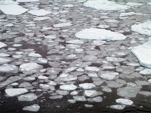
09-23-05 Ship Position at 2005/09/23 10:39:01 UTC Longitude: 39 51.963 E Latitude: 82 17.933 N "IBCAO" depth: 1551 m  Yes, we reached the ice edge! During night we made good distance. Healy’s average speed increased to more than 5 knots and lighter ice conditions prevailed. Signs of relieve and a lot of smiles are on the faces of our Swedish colleagues aboard Healy. They will depart for Oden in the evening so that they can meet a flight arranged by the Swedish Polar Research Secretariat in Lonyearben, Svalbard on September 25. It is strange to see them packing. We have lived and worked together for almost 8 weeks. At 15:00 we have a little ceremony on HEALY to say farewell to them and the icebreaker ODEN.  I am on the bridge studying the pancake ice The ice edge area is a very interesting area. Seals, polar bears and birds are spotted. Frazil ice, grease ice and pancake ice forms here. Pancake ice is mostly circular patterns, 1-10 ft in diameter, up to 4 inch thick with raised rimes caused by pieces hitting one another. Seawater freezes at a lower temperature as fresh water (29 F, -2 C), because of the salt it contains. When it freezes it looses salinity. The thin sea ice which forms first is flexible, it bends without breaking also called Nilas, a thin elastic crust of ice. We spotted an iceberg as well.   Icebergs are a totally different story. An iceberg is freshwater ice. It never was sea water. A berg is an ice mass that has broken away from a glacier or a margin of an ice cap, where it meets the sea. The Greenland ice cap, Ellesmere and Devon are sources. Sea currents transport icebergs around. Small ice bergs are called growlers (less than 1 m). Only the large ones last long enough between 2 to 3 years to get as far south as Newfoundland. When Titanic was hit 1912, she was south at 42 degrees latitude, closer to the equator as to the poles.   Our ship track from Dutch Harbor, Alaska to Svalbard, Norway |
  |
1 User(s) are reading this topic (1 Guests and 0 Anonymous Users)
0 Members:

|
NSF Acknowledgment & Disclaimer | Time is now: 30th October 2024 - 11:31 PM |
Invision Power Board
v2.1.7 © 2024 IPS, Inc.


