( Log In ) Log In is for TREC Teachers & Researchers only
 TREC Virtual Base Camp > Geophysics: Healy Icebreaker > Teacher's Journal (Ute Kaden and Ruben Fritzon)
  |

| Ute_Kaden |
 Aug 9 2005, 07:53 PM Aug 9 2005, 07:53 PM
Post
#1
|
 TREC Teacher  Group: TREC Team Posts: 203 Joined: 27-April 05 Member No.: 10 |
The Bering Sea and the Bering Strait
8-7-05 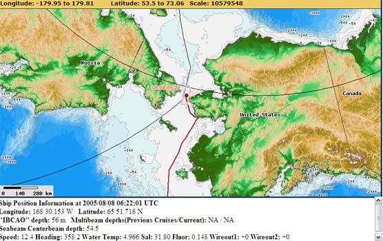 Russia and Alaska are only 53 miles (85 km) apart! The Bering Sea is bordered by Russia, Alaskas mainland, the Aleutian Islands, and the Commander Islands. At the northernmost part lies the Bering Strait where Russia and Alaska almost touch. I woke up 7:30 a.m. and somebody pointed out that it is Sunday. The daily routine on the ship lets one forget that days have names. We are sailing the Bering Sea, following the Bering Strait toward the Chukchi Sea. 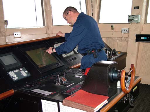 LCDR Dalitch is checking the course of the Healy The Bering Sea, bridging East and West, is a domain of raging storms, stifling fog, of winter darkness and relentless ice. It also teams with life, sustaining one of the most productive ecosystems on Earth.  Can you see the stifling fog of the Bearing Sea? The Healy had to stop 6 miles west of Nome at the Alaskan coast. Our Japanese scientists had forgotten some equipment which needed to be flown in by Helicopter. It was a welcome break from our daily routine to watch the flying operations. 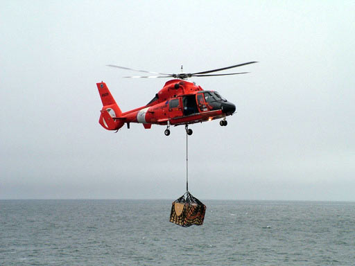 Japanese equipment arrives  Hirokatsu Uno is in a hurry putting on his mustang suit which is required for working on the fantail of the ship The Bering Sea is home to millions of animals and provides us with many resources. In recent years, scientists, Native people, environmentalists and fishermen have noticed that the Artic region is changing dramatically. Through research and observation, we are trying to understand these changes. Our current mission on the USCGC Healy is part of those efforts. Preparations are underway to get the science equipment ready in the main science lab.  Leonid Polyak (coring scientist), Dennis Darby (Co-Chief Coring), Martin Jakobsson (Scientist coring) are interpreting coring data  Main science lab of the Healy. Bjorn Eriksson is calibrating the core reading sensors. Now here it is. The photo of the Bearing Strait that is 55 miles wide between Cape Prince of Whales, AK Seward Peninsula, and Cape Dezhnev, on the Chukchi Peninsula. Cap Dezhnev is the easternmost point in Asia named after a Russian Fur trader who explored Siberia in 1648. Eighty years later Vitus Bering, a Danish mariner in the Russian navy, first sailed the sea that bears his name. Inclement weather kept Bering (and us on the Healy) from sighting the American continent.  Like Vitus Bering we were unable to spot any land sailing through the Bering Strait. Best regards, Ute |
   |

 
|
|
2 User(s) are reading this topic (2 Guests and 0 Anonymous Users)
0 Members:

|
NSF Acknowledgment & Disclaimer | Time is now: 18th April 2024 - 11:35 AM |
Invision Power Board
v2.1.7 © 2024 IPS, Inc.